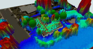
Light Detection and Ranging (LIDAR) uses lasers to measure the size, shape, area, and other physical characteristics of proposed building sites. These measurements can then be used to generate highly accurate 3D images of landscapes, structures, and other features.
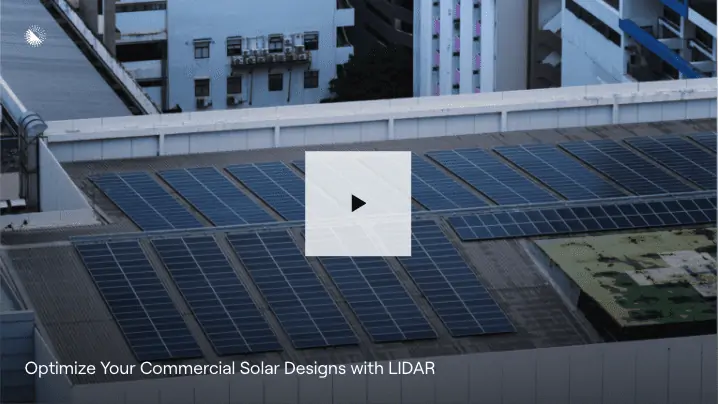
HelioScope now offers LIDAR, and it’s a real game changer for commercial and industrial (C&I) solar design. In a recent webinar, Amanda Mayo, Manager of Enterprise Customer Success for HelioScope, showed LIDAR in HelioScope in action. Watch the entire webinar on-demand to see exactly how it works for C&I projects, and the value it adds.
To give you a sneak peek, let’s look at two of the most important benefits of LIDAR for C&I projects: speed and accuracy.
LIDAR is now integrated in HelioScope. Currently in Beta for Enterprise customers, you can access Helioscope’s LIDAR tool by joining the waitlist.
Speed: efficient site identification and design
The first step in creating any large-scale solar project is finding the right location for the system. After that, the exact position of the installation has to be identified to maximize its solar potential and minimize local environmental impact.
Heliscope’s LIDAR mapping accelerates both of these steps, providing access to 3D satellite imagery and solar energy system design tools all in one place. You can simply toggle between imagery sources for mapping, terrain, and LIDAR data to help accelerate location spotting and site identification.
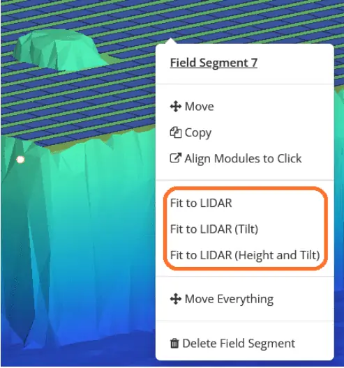
Once you’ve selected a site, Helioscope’s unique “Fit to LIDAR” tool can calculate the optimal building location based on the unique features of the site, the local sun path, heights of surrounding tree canopies, and more.
None of this matters if it’s not easy to use, however, and HelioScope’s LIDAR mapping is as easy as a few clicks. You can use HelioScope with LIDAR to quickly create site designs for large-scale solar projects and confidently pass them on to team members, clients, or other project stakeholders.
Accuracy: avoid costs with fewer design changes
Of course, speed doesn’t help if the measurements aren’t accurate. With real-world data in every step of the initial development phases, LIDAR helps prevent the costly design changes that often come with inaccurate estimates or uncalculated assumptions of a proposed building site.
In addition to generating precise 3D models of any buildings on a site, solar developers can use Topographic LIDAR to gather detailed information for open fields, agrivoltaic installations, and more. With raw data points and distinct GPS coordinates, LIDAR in Helioscope can be used to identify challenges such as trees, hills, riverbeds, and other variations in surface elevation.
Put simply, LIDAR mapping means fewer surprises down the road when an on-site survey is conducted. In turn, this leads to fewer expensive site visits before construction.
By keeping everything together in one platform with HelioScope, the accuracy of LIDAR data perpetuates through the entire solar development process. Together with API integrations and other features, information from LIDAR reports can be automatically populated into site reports and customer proposals without having to worry about inaccuracies from estimations or human error.
Wrapping up
LIDAR is one of the most exciting new features in HelioScope. To learn more about how it can help cut time, effort, and cost from your C&I projects, make sure to check out our post introducing LIDAR for HelioScope. Then watch the webinar to see exactly how the features work, and how easy it is to use.
If you are a new or existing Aurora customer interested in using HelioScope’s LIDAR feature for C&I solar design, please join the waitlist.